Portfolio
Below are examples of my work .
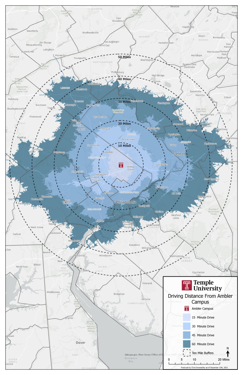
Driving Time Analysis for Remote Workplace
Alumni Location Application
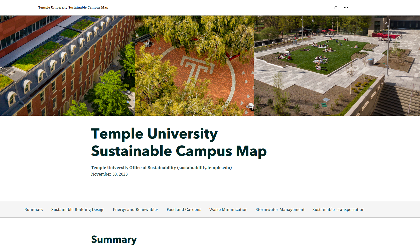
Sustainability Campus Tour for Main Campus - explore here:
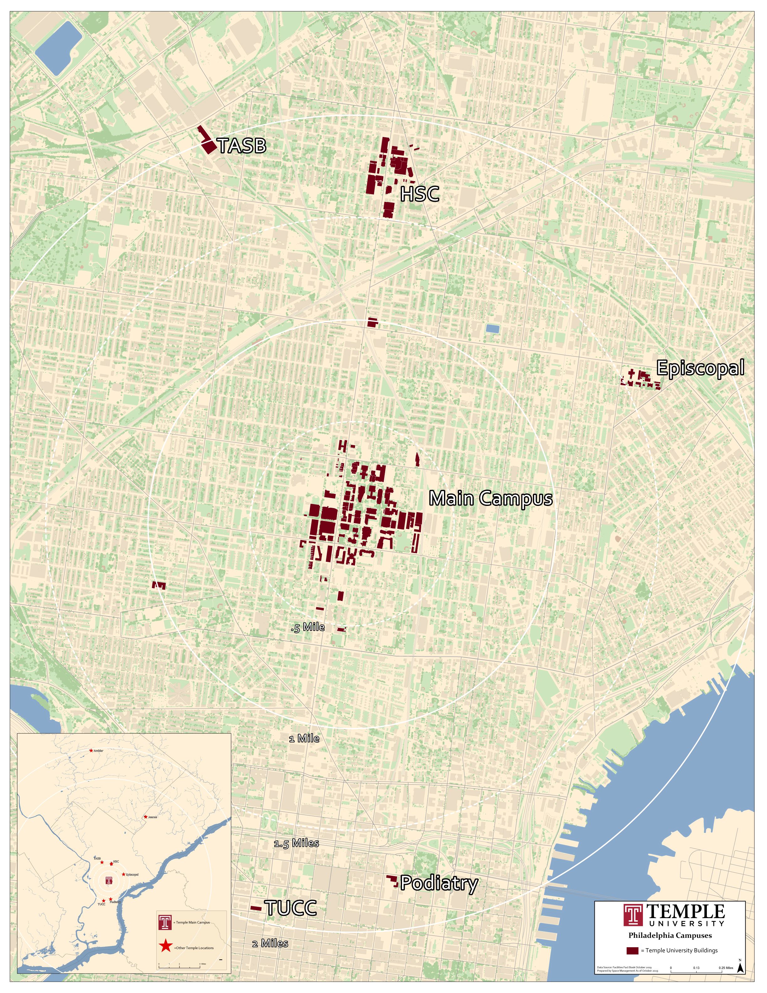
City Wide Campus Locations
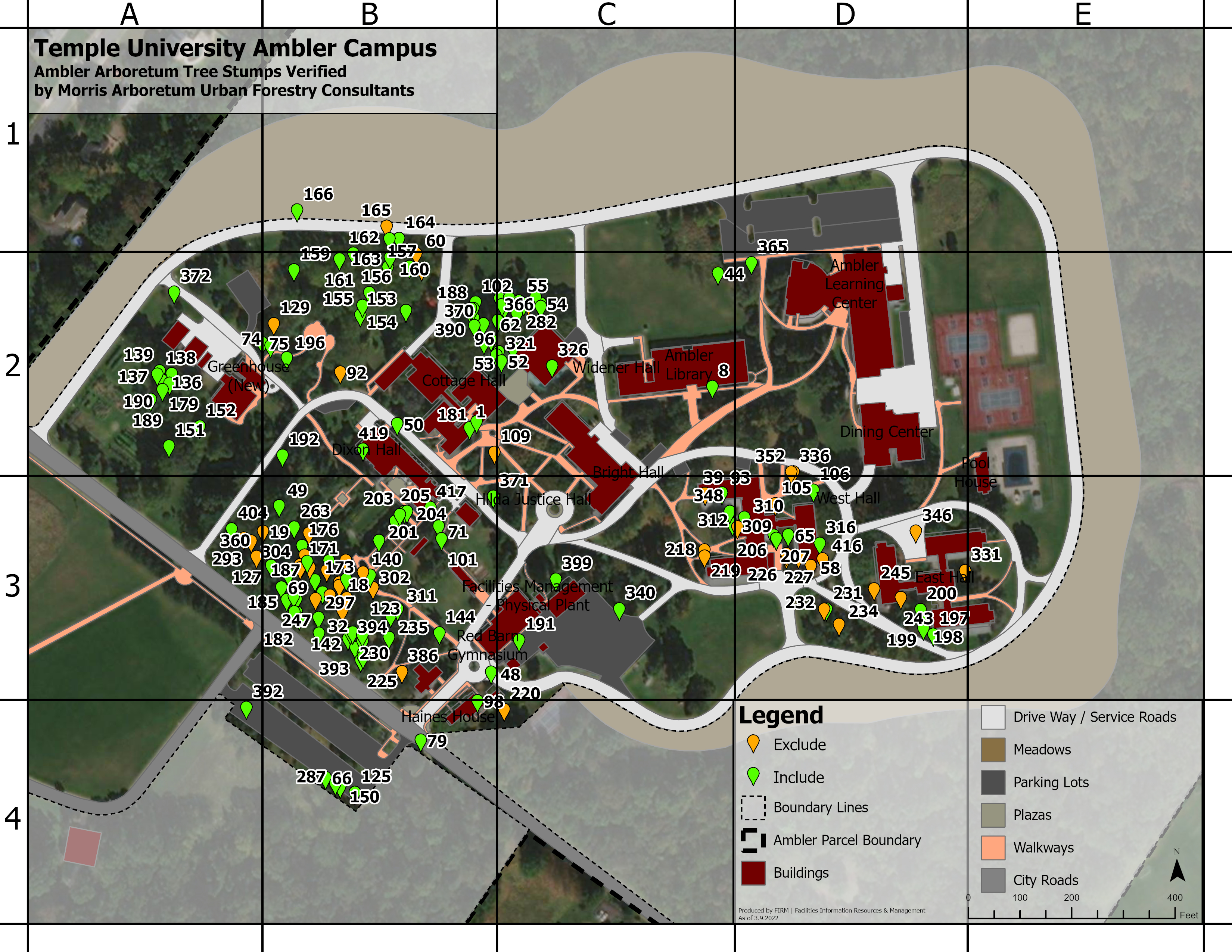
Temple University Ambler Tornado Tree Damage Analysis
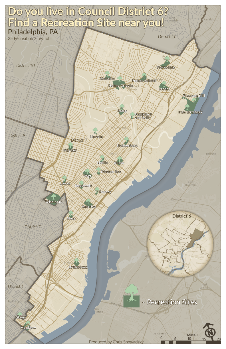
Recreation Sites in Philadelphia District
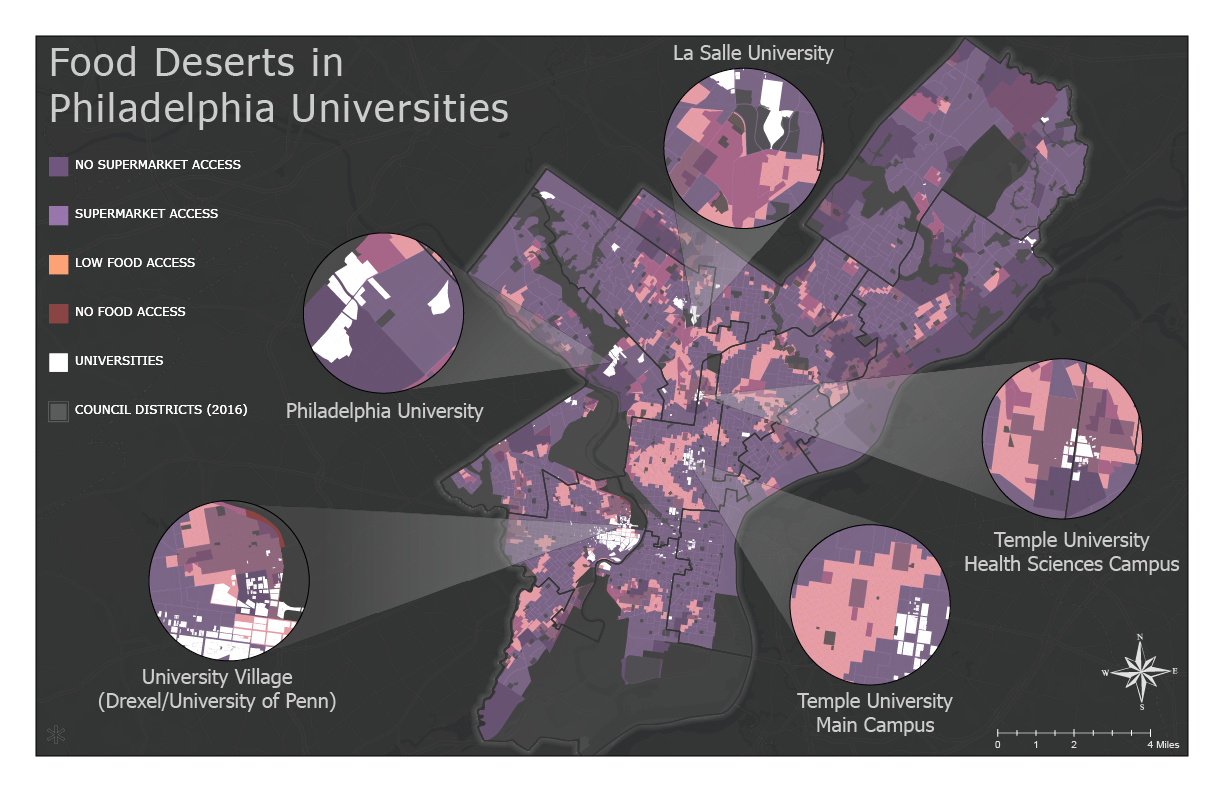
Food Deserts in District 6
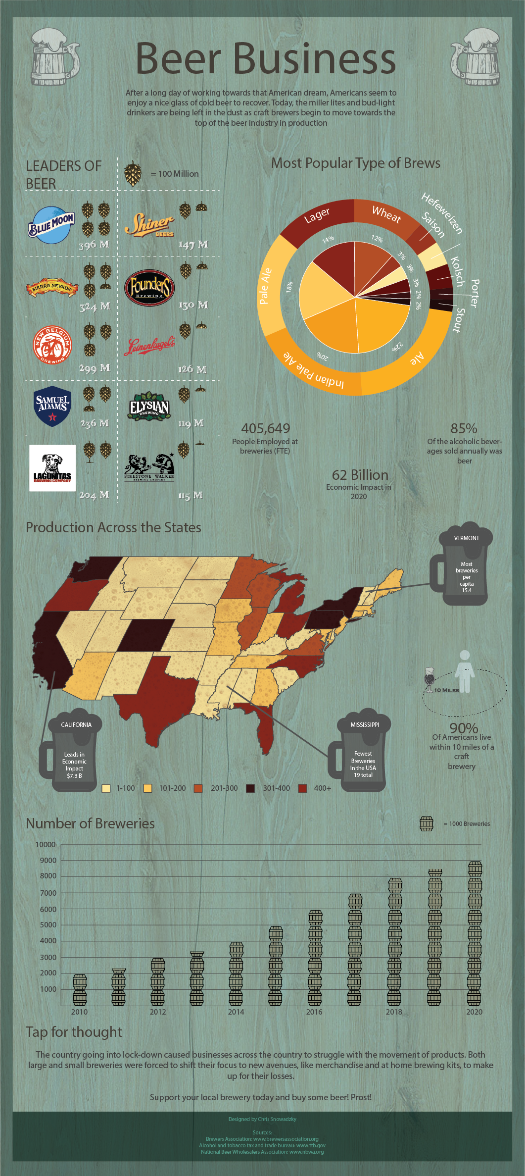
Infographic about Beer Across the Country
Resume

GIS Manager / Assistant Director @ Temple University
May 2017 - July 2025, Philadelphia PA
- Established a GIS Enterprise utilizing the ArcGIS Online platform to host the 100+ data sets surveyed over the years as well as the 20+ applications created for different departments across the university.
- Created online applications utilizing the Esri platform - providing unique solutions adapting to the department's use of GIS.
- Performed spatial analysis to support (real estate, sustainability, facilities, campus safety, and institutional advancement) projects using ArcGIS Pro and ArcGIS Online suite of applications.
- Obtained, extracted, modified, converted, processed, uploaded, exported and performed quality assurance of complex data in non-GIS format (AutoCAD, Revit, Excel, pdfs, etc) and converted to GIS for easier use.
- Presented application of GIS to stakeholders across the campus, creating customized reports and mapping applications (Dashboards, Storymaps, or custom web maps) to fit their needs.
- Trained novice GIS users on how to use ArcGIS Online, Field Maps, Survey123, Dashboards.
- Launched the Temple Open Data Site - empowering the students and staff of the university with campus related data so they can conduct their own research of the campus environment.
- During Covid Outbreak, collaborated with university stakeholders to evaluate classroom occupancy levels for over 500 rooms across 3 campuses and developed a plan to maximize the university’s ability to service over 30,000+ students and staff, while remaining in compliance with Covid guidelines.
- Created materials to explain standard operating procedures required to maintain quality and validity of ArcGIS Online data sets in departmental surveys - ensuring that all data sets are achieved using the same SOP.
Contact
Thank you for taking the time to explore my work and see a sneak peek of who I am. I am currently looking for a job and would be thrilled at an opportunity to continue to grow my GIS skills - so please if you are interested in my work please feel free to send me an email below. Thank you.